
      
  
Admiral Log
Tuesday, Aug 18
Underway even before the
sun had awakened, into a light blanket of fog that still
covered the water. We were making our way further up the
coast and towards section of Myrtle Beach where one would
see showcase after showcase of golf courses and mansions.
(PHOTO #344)
.jpg)
Photo 344: Morning Mist - Myrtle Beach
Each community trying to
have something unique from the other. How about this for
being unique – a cable car that took one from one side of
the water (driveway) to the other side where the golf course
and club house were located. Golfers were out early on the
course as we were out early on the ICW. (PHOTO #347 and
348)
.jpg)
Photo 347: Myrtle Beach Golf Course - Cable Car
.jpg)
Photo 348: Golf Course - Myrtle Beach
Less than two hours into
our day, we had crossed into NC. We checked watches and
mileage and began to calculate our timing to our first
possible obstacle of the day – Sunset Beach Bridge (Pontoon
type), 7-Ft in height. This would become the first of three
bridges that loomed in front of us. We hoped we might be
able to navigate all three during this day. Only time would
tell how many we might actually safely pass through on this
day.
Challenges to be met
included making good time (such as winds and currents in our
favor and having few’ no wake zones’ requiring us to drop
speed for extended lengths of travel) and arriving to each
bridge BEFORE the hour. Bridges opened only on the hour and
between the hours of 7am and 7pm. (PHOTO #350)
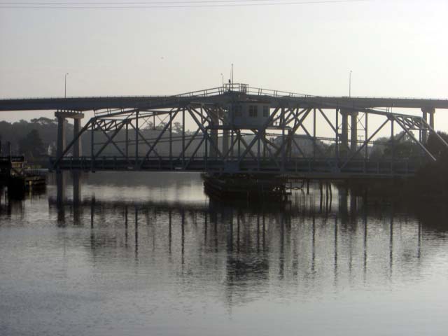
Photo 350: It Swings
AHHH…but as we covered
distance within the waterways of NC, it was to be so much
different than the serene SC travel. NC is indeed the
playground for young and old. Commercial and pleasure
boats, including jet skies and other fun-seeking vessels
zipped around mile after mile. Fishing was indeed a
favorite of this state and fisherman of all shapes and sizes
and from off piers, boats, and shoreline kept us company for
much of the day. Need more bait, then wait….just cruise by
and pick some up from this water-based bait store barge!
(PHOTO #373)
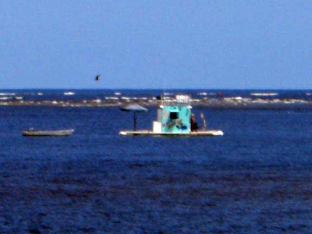
Photo 373: Bait Barge
Other differences noted
on this first leg of our journey into NC were the numerous
inlets and churning waters and treacherous currents that
wanted to dance us around as an unwilling dance partner.
Michael, Rob and I took turns throughout the day at the
wheel and provided needed breaks to one another. A ‘quick’
fuel stop that would have impressed even NASCAR Pit Crew
made up another part of the afternoon as we continued to
race onward, trying to clear as many of the three bridges
before time or daylight ran out! (PHOTO #361, 370, 320)
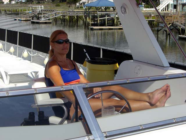
Photo 361: Admiral Doing Wheel Time
.jpg)
Photo 370: Michael at Lunch - Front Porch while Paddlin
.jpg)
Photo 320: Rob at Gas Station
As we danced awkwardly
at times with the currents, we passed several notable
points:
NOTABLE POINTS
·
Cape Fear. Have no
fear. While Cape Fear was dubbed such out of respect for
the area’s treacherous waters, buoyage an dredging have made
navigating the region a much easier experience. What we did
learn is that ‘Fear’ could easily have been caused by
pirates who used to terrorize this region. Pirate tales are
infamous in this ‘neck of the waters,’ and Blackbeard is one
such pirate that we know we shall hear more about as we
travel north towards Hatteras. Grounded boats were sure pry
to pirates In these waters!
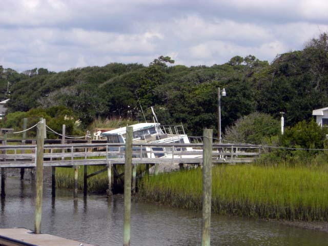
Photo 364: Lost Houseboat
· Wrightsville
Beach. We pay homage to Jerry Medkser, Michael’s brother
who served in the Coast Guard for over a decade and was
stationed here in Wrightsville Beach for four of those
years. We captured a few photos and share in respect for
his service and hope that photos might evoke fond memories.
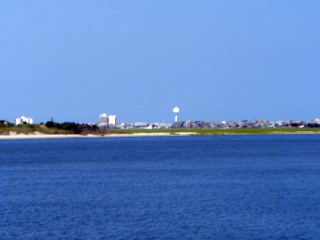
Photo 374: Wrightsville Beach
WHAT ABOUT THOSE
BRIDGES
And what about those
bridges mentioned early in the day? Did we surrender to
them or did we successfully conquer and have safe passage
through all three? Well, the total distance and total time
on the water this day should give you answer to whether we
surrendered or whether we successfully conquered.
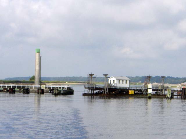
Photo 359B: Pontoon Bridge
Our day of traveling
ended at 9:30pm. We found portage at a marine aptly named
Caspers. And, like a ghost, we shall float out quietly at
sunrise.
Total distance: 130
miles Total time: 14 hours
From: Canright, Shelley
Sent: Tuesday, August 18, 2009 9:04 AM
Subject: Admiral Update - Now in NC
We
were underway in the pre-dawn light, with light blanket of
fog kissing the top of the water.
By
8:30am, we had passed mile marker and taken photo of 'spot'
signifying the passage over the state line of NC.
We
shall encounter couple of bridges along the way that shall
require 'swing' or lift for us. These bridges appear only to
lift on the hour. Thus, depending on our arrival to these
bridges, we can have either a short or long wait period.
We
have come upon the first of them at Sunset Beach. We reached
it with 15-minutes to spare. At this moment, it is swinging
open for us and we are moving through. Pictures to be sent,
later.
From: Detroye, Diane D.
Sent: Monday, August 17, 2009 10:56 PM
Subject: RE: Admiral's Log -- Monday, August 17 (Charleston,
SC to Myrtle Beach, SC)
Shelley,
Katie and her family are vacationing this week at Emerald
Isle, NC. It looks like you might be near Emerald Isle by
Wednesday or Thursday?
Perhaps you and Katie can communicate and she could gather
the family on the shores to wave as "Now We're Ready"
paddles by?..... shoreline photographic evidence for the
First Mate to post?
Just building connections between people, Diane
From: Canright, Shelley
Sent: Tuesday, August 18, 2009 6:08 AM
Subject: RE: Admiral's Log -- Monday, August 17 (Charleston,
SC to Myrtle Beach, SC)
Morning to both of you. Just getting ready to have that
first cup of Joe and to ready the lines for pre-dawn push
off. Shall take look at map to see just where Emerald Isle
might be in relationship to us and the distance. We travel
approx 110 miles a day.
Oops Captain giving me that LOOK...got to get off email and
pull my weight. Geesh, get two captains on deck and they
get bossy. I think they forget just who is the ADMIRAL of
this vessel. :-)
From: Katie
Sent: Tuesday, August 18, 2009 7:12 AM
Subject: RE: Admiral's Log -- Monday, August 17 (Charleston,
SC to Myrtle Beach, SC)
Hey Ladies!
If
they are coming up the intercoastal waterway, Emerald Isle
is when they get to the Bouge Sound. I would LOVE to meet
the "pirates" as they come trawling by!
Like Shelley, I'm having that first cup of coffee, seeing
what kinds of responsibility I'm going to neglect today on
line, and then I'm starting my vacation day! Yippee!!!
Bon voyage!
From: Detroye, Diane D.
Sent: Tue Aug 18 07:12:59 2009
Subject: RE: Admiral's Log -- Monday, August 17 (Charleston,
SC to Myrtle Beach, SC)
Sigh. And I'm here at work without my 1st cup of Joe cuz
I've got to wait til I do the blood work for my annual
physical.
AND I'M NOT ON VACTION IN A NICE SUNNY PLACE!!!!
From: Canright, Shelley
Sent: Tuesday, August 18, 2009 8:50 AM
Subject: Re: Admiral's Log -- Monday, August 17 (Charleston,
SC to Myrtle Beach, SC)
Looks like EI is at mile marker 226 which is approx 145
miles up from where we started the day. Depending how far we
get, today...due to current and several bridge openings that
we must time correctly....we should be nearing EI, tomorrow
From: Katie
Sent: Tue Aug 18 08:19:16 2009
Subject: Emerald Isle
Excellent! Let me know if you plan to dock for "supplies and
sustenance" in Morehead City or Beaufort NC, let us know.
I'm assuming you are staying on the intercoastal waterway?
Tally Ho!
From: Canright, Shelley
Sent: Tuesday, August 18, 2009 9:32 AM
Subject: Re: Emerald Isle
We
are indeed on the ICW. Looks like we have a 65-ft bridge at
EI to pass under. Shall call you when we get closer on our
status.
We
passed into NC around 8:30am and at 9am, we had passed
through an opening of the Sunset Beach (7-ft) bridge. We had
a 15-minute wait. Far better to be early rather than late
when it comes to hourly bridge openings!
My
turn at the wheel is 10am...
--The Admiral
Enjoy your vacation!
From: Detroye, Diane D.
Sent: Tuesday, August 18, 2009 9:42 AM
Subject: RE: Emerald Isle
Just to be clear, Katie. If you do indeed link up with the
Admiral and two Captains, there is one overriding
requirement -- photographic evidence.
Either up-close-and-personal at a dock, or waving from the
bridge as they pass underneath.
First Mate Bill Anderson has established a home base posting
of the Admiral's status reports: http://paintrock.net/boat/docs/aug_17,_2009.htm
We
have yet to see independent confirmation that this journey
is happening (think faked Moon landings) and it's not just
Shelley and Michael having a grant 'ole time at their
Capital Hill home with elaborate use of backdrops, props,
and random tourists shanghaied from Union Station.
Skepticism will abound if all you capture is a grainy
B-Berry photo.
(;-)
From: Canright, Shelley
Sent: Tuesday, August 18, 2009 9:51 AM
Subject: Re: Emerald Isle
Hurmph!
And with that response, the Admiral is off to take turn at
the wheel. I suppose you will want photo proof of THAT too!
(wink)
From: Anderson, Bill
Sent: Tue Aug 18 10:00:38 2009
Subject: RE: Emerald Isle
I've had a heart-to-heart, just one Bill to another, with my
namesake hurricane and I've been assured you have nothing to
worry about. Nothing at all. Smooth sailing, according to
Bill. No worries. Mostly. Here's his picture.
See?
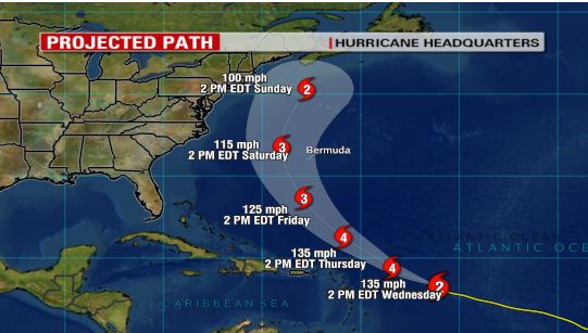
Projected Path of Hurricane Bill
From: Canright, Shelley
Sent: Tuesday, August 18, 2009 11:21 AM
Subject: Re: Emerald Isle
Just coming off the flying bridge after completing my 'wheel
time'. I was pleased to read this communication from First
Mate Bill. Mostly, that is!
From:
Currier, Patricia A.
Sent: Tue Aug 18 12:32:11 2009
Subject: Re: Admiral Update - Now in NC
-
Do you need someone to pick up your mail,
or do they put it through the door?
-
If you get in on the weekend and I can
pick you up (in my relatively new car, so don’t take
this the wrong way), —have you guys been able to shower
on the boat (ie, do you stink???)
From:
Canright, Shelley
Sent: Tuesday, August 18, 2009 3:14 PM
Subject: Re: Admiral Update - Now in NC
Wheew! What a day this
has been....no issues, just wind, open water, sun and
currents to where one down. We are doing as fast as pit stop
(think NASCAR) that this baby can fill as we have two
bridges ahead of us that potential could shut us down. Both
bridges are only 12-ft and open.only on the hour until 7pm.
We are currently at Wrightsville Beach -Marker 283 - and
must pass first of the 12-ft bridges at Marker 260 and the
second at Marker 240. Winds and currents have been against
us for most of the day and trying to maintain 10mph has been
challenging. Do the math...
Now to answer questions:
1. Mail is being delivered inside house thru mail slot.
2. We shall be devoid of the perfume of ICW should a pickup
be possible. We have a shower on board and if we run out of
water, our marine has showers and so we can pretty up before
pickup and ride into Big City.
From:
Anderson, Bill
To: Canright, Shelley
Sent: Tue Aug 18 18:44:42 2009
Subject: Which way?
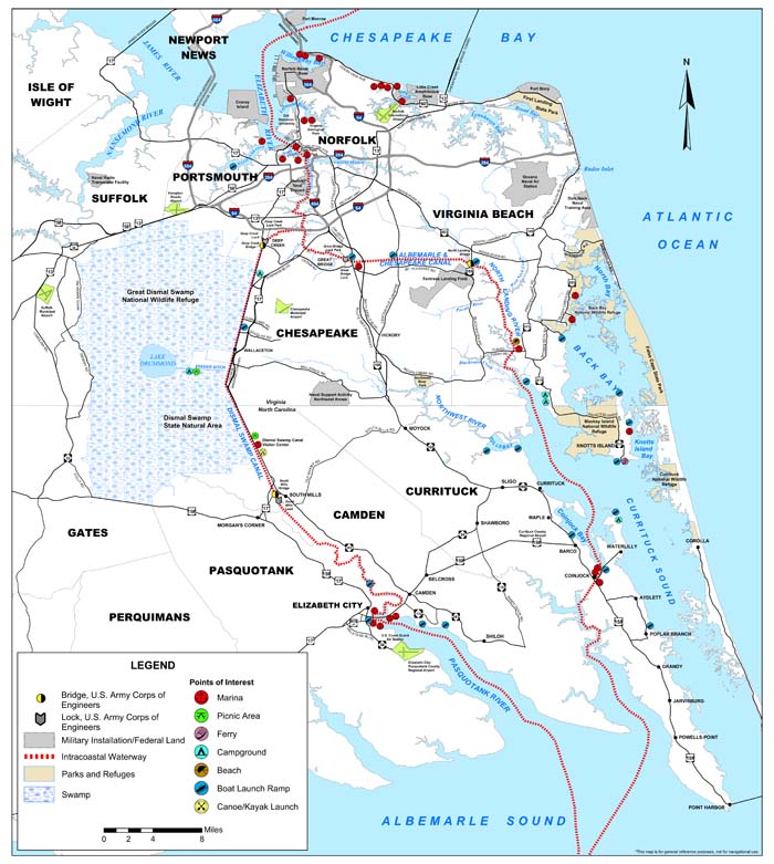
Shelley, when you get up to the Albemarle Sound, do you plan
to take the ICW through the Dismal Swamp Canal or the
Albemarle and Chesapeake Canal? Just wondering.
From:
Canright, Shelley
Sent: Tuesday, August 18, 2009 8:21 PM
To: Anderson, Bill
Subject: Re: Which way?
We're looking at what
might be obstacles and challenges ( bridge lifts, etc) and
look to select way wiith least. I have heard that Dismal
Swamp is recommended for those folk on a leisure pace. Not
sure that is us any longer.
Matter-of-fact, e are atill driving at this time to get more
miles behind us and to locate a Marina. We just passed the
third and final bridge that we had worried about.
At this moment, we have om our spotlight...and I am typing
this message while holding flashlight!
Likely no wireless this evening to allow me to send today's
log or photos.
Good night, mate!
From: Canright, Shelley
Sent: Tuesday, August 18, 2009 10:46 PM
Subject: TARGET:: Emerald Isle (NC) -- At First Light
(August 19)
Gang:
LONG day. Fourteen
hours we paddled and covered 130 miles. The boys ran the
gauntlet and victory was upon us...the three bridges that we
expected one or more to stop us short of our goal did not
trip us up. We passed the third one at 8pm...but it then
put us between anything or anywhere we might anchor. Thus
for another 1-1/2 hours with spotlight on and I gazing at
stars and saying prayers, Michael and Rob slowly traversed
down the narrow channel, keep an eye out for any reflection
of a red or green marker.
The short version is
that we did not hit anything and found portage at 9:30pm at
a marine aptly named Caspers. And being a good ghost,
spirits were with us as we navigated into the pier and
docked. And, like a ghost, we shall float out quietly at
sunrise.
The main point of this
message is not to give you so much as an update -- as I MUST
complete the official log with photos and get off to the
First Mate before I can call it an evening -- but to let
everyone know that it shall be highly unlikely that Katie or
member of her family shall be able to capture a photo or
even wave at us in the morning. You see, we have ported at
approx mile marker 227 and Emerald Isle bridge (Cedar Point
for Katie's benefit) is at marker 226.
NOTE: This means
Emerald Isle is one mile to the north of where we have
bedded down. So, I am afraid like Casper, the ghostly
houseboat, 'Now We're Ready,' shall have passed and taken
its crew further up the channel not long after first light.
We shall wave as we
pass under the bridge and pretend that the Pruzan Family was
on hand to bid us well on our way.
- The (elusive) Admiral
|