
      
  
Admiral’s Log
Thursday, August
20, 2009
Local fishermen and dock
master in Belhaven, NC had cautioned us from continuing any
further on Wednesday afternoon after stopping for fuel. Up
ahead of us was an area with extreme hazards that in dusk
and darkness is not someplace one would want to be. Seemed
sensible to us ‘newbies’ and folks from the big city and so
we settled down. We figured we could also add a
quasi-stimulus package to the local community and so
sporting a blue golf cart we went sightseeing while hunting
for the ‘downtown traffic light’ and recommended
restaurant. We discovered that we were not SO out of place
in driving around in a golf cart! (PHOTO #415 and 416)
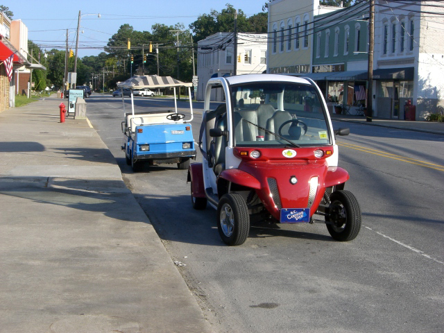
Photo 415: Another Scooter
Photo 416: Glass Design
The decision to drop
‘anchor’ in the late afternoon rather than early evening
also afforded us the opportunity to look ahead in our trip
to the section where we would have a key decision point (for
my NASA folk, you can see that I have not been away so long
that I have forgotten the vernacular of good project
management!). The key decision point was whether we
took the ‘fork’ in the ICW and took the route along the
Great Dismal Swamp or the other fork that carried us up the
Albermarle and Chesapeake Canal. The decision point would
have to be made at marker 50. We expected to make that
point by mid-afternoon on Thursday.
Either direction would
offer its own set of challenges and thus the decision to be
made was which route might the challenges be minimal in
comparison and where might risk mitigation be in our favor
should we meet head on to one of the challenges. We
reviewed travel books, navigation charts, and even a DVD we
had purchased before the trip entitled, “Snowbirders Guide
along the Atlantic Intracoastal Waterway.” A brief caucus
was held with the Captains. By the time we went to bed, we
had come to agreement on the course to take.
Way before first light,
we left the shores of Belhaven, NC to make up some time and
distance we had lost the day before. Sunrise would be
one-hour after we left and so with the creeping of dawn, we
were witness to the lifting of the fog on the Alligator
Canal and awakening of birds and fishermen making haste to
drop crab traps. (PHOTO #419a/b, 420, and 430 )
.jpg)
Photo 419a: First Light, Alligator River
.jpg)
Photo 419b: Almost Sunrise, Alligator River
Photo 420: Lone Fisherman
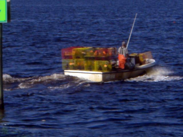
Photo 430: Morning Shrimper
We were also witness to
those hazards that the locals had told us about. It would
have been a most harrowing experience to have attempted to
navigate this narrow canal with all the dead trees laying on
either side of the shores and the huge tree stumps. I can
only imagine the poor soul that got caught in this canal and
decided to drop anchor! That would like be one anchor that
would have to be left behind as it would most assuredly have
gotten snagged on a submerged stump or tree! While
hazardous…it did have its own beauty and awe. (PHOTO #426)
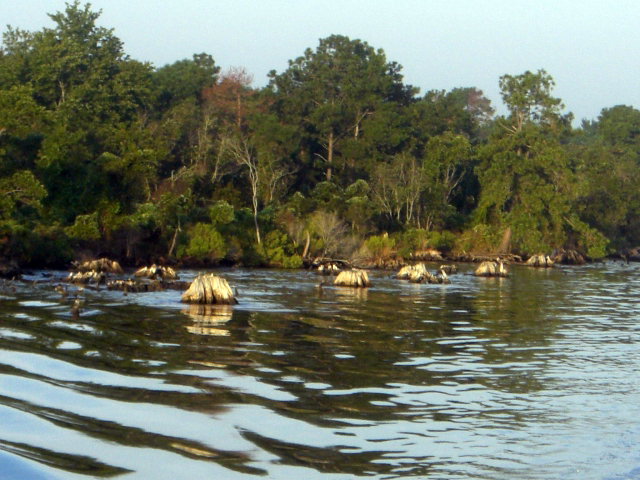
Photo 426: More Stumps
By 10:30am we have come
up on the last LOW bridge of NC that we must make passage
through. Naturally, it is called the Alligator River Swing
Bridge and stands 14-ft vertical. When we have our radio
antennas dropped and our radar dish lowered, we are close to
20-ft in height. Depending on the tides, we can sometimes
pass under bridges that measure 18- to 19-ft. tall. This
one we shall have to call and request an opening. What was
of most significance to us with this particular bridge was
that we were at mile marker 85 (meaning miles from Norfolk,
VA) and it was at this moment that I heard the first radio
transmission that identified its calling location as
HAMPTON ROADS.
Hampton Roads…that is
Virginia…that is my old stompin’ grounds and location of
NASA’s mother center – Langley Research Center! Technically,
this placed us within ‘calling’ distance to home away from
home. Virginia, we are coming!
ADVENTURE IS FOR REAL
AND NOT A HOAX.
It is worth a pause to also update this log on the news
received early this morning that a RELIABLE, INDEPENDENT
source did confirm sighting of this vessel near Emerald
Isle, thereby debunking and stifling the rumors that this
boat adventure was a hoax. Below is the official statement
submitted. At the time of this log a permission form to
allow posting of this person’s photo was being sought. Once
the photo release and photo is received, it shall be posted.
CONFIRMED SIGHTING
STATEMENT:
“Even though this Pruzan didn’t actually see the boat – My
mother-in-law saw the ghost ship as it passed her house this
morning! I asked her if she saw a houseboat while she was
having coffee this morning on her porch. Oddly enough – she
said yes, it was named something like ‘Now We’re Movin’ and
it had red swirly looking things on the outside. They
(in-laws) live at water marker 26 in the broad creek area of
Bouge Sound (between Emerald Isle and Atlantic Beach
bridges). They are right on the water and the eyes of the
Pruzans were upon the Admiral’s vessel!”
WAGER POOL – PLACE
YOU BETS NOW.
Now that we have settled that little matter, I share now a
WAGER POOL that is reportedly being started back in
Washington, DC and at NASA Headquarters. The rumored plans
are that the pool is to determine where and when the vessel
might turn right and head for Europe. The basis of this
pool is judging on the current latitude, the Admiral could
simply stay on this course and end up going through the
Straits of Gibraltar and into the Mediterranean Sea. Thus,
either I show up at the office on Monday, August 24 or this
log continues and details adventures in the South of
France. Hmmm…..should we throw the decision on which
course to take out to the readership for making that
decision….?!
A SECOND BET.
What about the ‘fork’ in the waterway? Shall the boat
journey on through the Great Dismal Swamp or up through
Abermarle and Chesapeake Canal? As we came up on the
Coinjock Bridge, it was decision time! Taking bets…….
The road traveled
thus far.. We
have traveled from Belhaven, NC and reached the perimeter of
the Hampton Roads region by 5pm. At this time moment, we
are running the gauntlet within a 28-mile section that is
filled with seven bridges and one lock, each with a
restricted opening time. Shall darkness and time snag this
vessel and stop this crew before it completes this run?
IF successful, we shall
reach mile marker zero of the Atlantic Intracoastal
Waterway. ‘Now We’re Ready’ shall have completed a
full run from Miami, FL to Norfolk, VA – all 1087 miles.
Not many dames can make such a claim and look and run so
well. Our little marathoner! Not to get cocky, though…we
still have a ways to go until nestled into home port near
Washington, DC.
Final note of the day.
Uh-uh…special operation games underway as we pass close to
restricted area…three boats sneaking up from the aft under
dark of night…suddenly stopped to our starboard side…a wake
and a sudden jolt to our boat…..starboard engine is down and
no power steering…now what could happen next??
Today's Emails
From:
Canright, Shelley
Sent: Thursday, August 20, 2009 5:47 AM
Subject: Have left the docks pre-dawn
We are underway under a
star-studded sky, as nature's lighting for us as we get an
extra early start (5:30am). We are heading towards Coinjock,
NC, which is about 130-miles north and is last point in NC
before hitting VA. Expect to be in VA, tomorrow. VA shall
hold its challenges for us with approx 20-miles of timed
bridge openings and one lock. This shall occur in early
stage of entry to this state.
Once we hit mile marker zero on the ICW, we shall be in
Norfolk and then have approx 180-miles as final leg --
taking 1-1/2 days. We have optimistically purchased plane
ticket for Captain Rob for Sunday from Dulles to Tampa.
Fingers crossed that all continues to go well. If any snags
that might delay us even for a day, then we shall have to
consider stopping at Norfolk so that Rob can get flight
home. He has commitments that he must keep. Without him...it
would be just Michael and me taking her into DC. YIKES!
Keeping monitoring the boat site for the 'action
packed'....okay, at least for some awesome photos.
Off with my flashlight to find that cup of coffee that I sat
down somewhere in the dark to get this quick note off fom my
blackberry.
Captain Rob and Michael are already wired.
Ahoy!
From: Detroye, Diane D.
Sent: Thursday, August 20, 2009 6:09 AM
Subject: RE: TARGET:: Emerald Isle (NC) -- At First Light
(August 19)
[Responding to yesterday's
mother-in-law silliness]
ROTFL!!!
Hat's off to MIL Pruzan!
From: Anderson, Bill
Sent: Thu Aug 20 06:18:36 2009
Subject: RE: TARGET:: Emerald Isle (NC) -- At First Light
(August 19)
Has anybody ever actually seen the mother-in-law? Didn't
think so.
From: Canright, Shelley
Sent: Thursday, August 20, 2009 7:51 AM
Subject: Re: TARGET:: Emerald Isle (NC) -- At First Light
(August 19)
(Sigh)...Katie, is it possible that you might supply photo
of mother-in-law? Be sure to get a photo release as this
might be posted to boat site along with statement of
RELIABLE, IINDEPENDENT source confirms sighting.
From: Katie
Sent: Thursday, August 20, 2009 9:30 AM
Subject: RE: TARGET:: Emerald Isle (NC) -- At First Light
(August 19)
Now that
can be arranged.
From: Detroye, Diane D.
Sent: Thursday, August 20, 2009 9:07 AM
Subject: RE: TARGET:: Emerald Isle (NC) -- At First Light
(August 19)
My
sides now hurt so much from laughing that I'm beside
myself!!
From:
Canright, Shelley
Sent: Thursday, August 20, 2009 8:01 AM
Subject: Re: Have left the docks pre-dawn
Correction to early
message re: mileage. I now have had coffee, have daylight
and have charts in front of me (rather than faulty memory).
From Belhaven (last night's port) to Coinjock, NC is
85-miles. From Belhaven, NC to end of ICW (Norfolk, VA) is
total distance of 135-miles.
FEASIBLE to cover this distance.....IF timing is in our
favor when we come upon the #*? bridges and one lock that
have designated openings. We either power through or start,
stop, wait, and start, again, repeat...
It shall all be told in the Admiral's Log....
From:
Canright, Shelley
Sent: Thursday, August 20, 2009 4:13 PM
Subject: Re: Have left the docks pre-dawn
We are now in the VA
waters and making progress towards Hampton Roads (Portsmouth
and Norfolk, VA) and the zero mile marker on the ICW. We are
currently at mile 29.
Might sound close....but the bridge and lock obstacle course
are still in front of us. It is like running the gaunlet for
the 28 miles. IF we successfully pass thru all of this, then
evening docking is planned in Portsmouth. IF not....
Once we get to mile marker zero, we are approx 180 miles to
home port!
From:
Canright, Shelley
Sent: Thursday, August 20, 2009 4:21 PM
Subject: Shelley heading towards Hampton Roads at this hour
via houseboat
Gang:
Depending on the next 5 hours, I am hopeful that by
nightfall I shall be docked at city close to Langley. And if
that happens, then should be coming round the bend sometime
tomorrow and passing through!
For current status of the day...see, below. I shall post
update to Admiral's Log and photos once I dock for evening
and gain wireless internet access. At moment, limited to
blackberry.
Bill Anderson is serving as First Mate and keeping 'boat
site' up to date:
http://paintrock.net/boat
Ahoy!
From:
Canright, Shelley
Sent: Thursday, August 20, 2009 10:10 PM
Subject: Re: Have left the docks pre-dawn
We reached the mile maker
zero at 9:30pm....but it might have been ground zero. We
were 2/10 of mile of where we planned to dock for evening
when something happened. We had three special ops boats off
to our starboard all decked out for some fun. They had
dashed up beside us and there was an aft wake that hit us, a
heavy thud was felt on the starbaord side and we were down
on one. Did we hit something? Did special ops hit us with
something?
We don't know...but only know that we shall seek
consultation when the marina where we are opens at 8am.
To top the evening...we have a log and photos that we wanted
to release...we had fun during the day in crafting the
content and selecting the photos. We are docked with no
wirless, so log shall have to wait.
   |